Today we built apps in Alteryx allowing a user to select parameters that would apply filters to a dataset containing records of crimes in the UK.
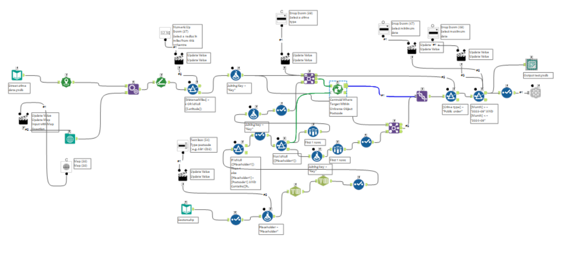
I constructed my app to allow a user to select a minimum date and a maximum date, then select a point on a map and/or select a postcode to zone in on. I should probably read up on control containers because finding a way to implement conditional tool activation ate up into a lot of my prep time. The logic used in the workaround can be deciphered in the screenshot below, centered around the second spatial match tool.
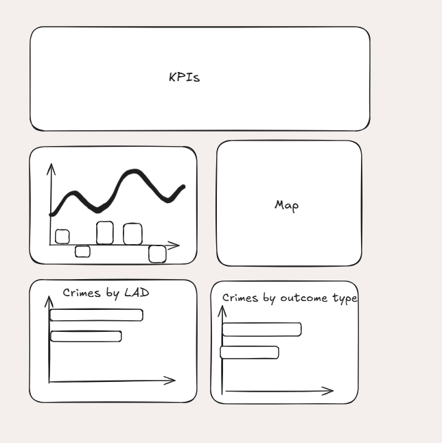
My plan for the dashboard was to create KPIs across the top, a density map displaying each crime and some bar charts displaying categorical information that can filter the other information.

The plan for my dashboard can be found here:

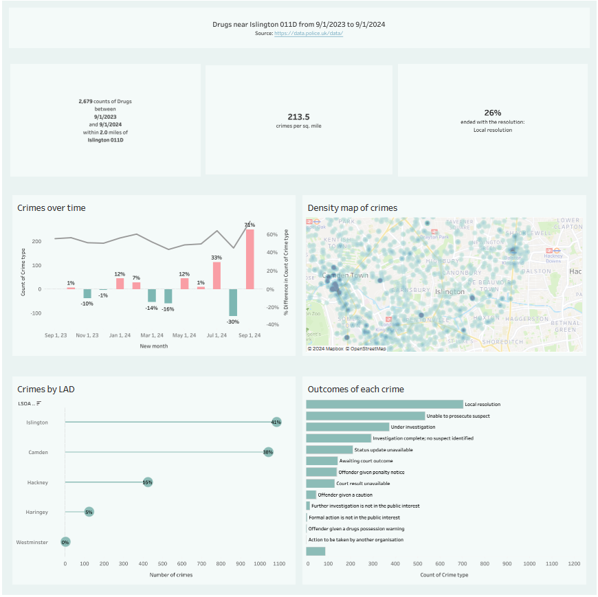
A screenshot of the dashboard can be found below, as well as a link to Tableau Public. For the purposes of giving an example, I focused on where I used to live in North London near Holloway Road.

Link to Tableau Public: https://public.tableau.com/views/Day2dashboard_17326411434930/Crimedashboardforselectedcrimes?:language=en-US&publish=yes&:sid=&:redirect=auth&:display_count=n&:origin=viz_share_link
