is a spatial data tool which allows you to join a set of points on a map and create a polygon.
Why is it useful?
If you have a set of longitude and latitude coordinates you can mark out an area of say x miles around a certain point.
How does it work?
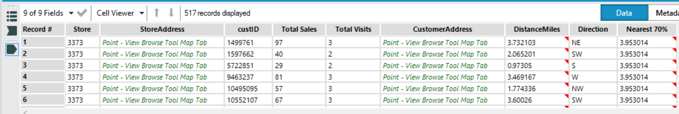
Here’s an example looking to find the closest 70% of customers to each store.
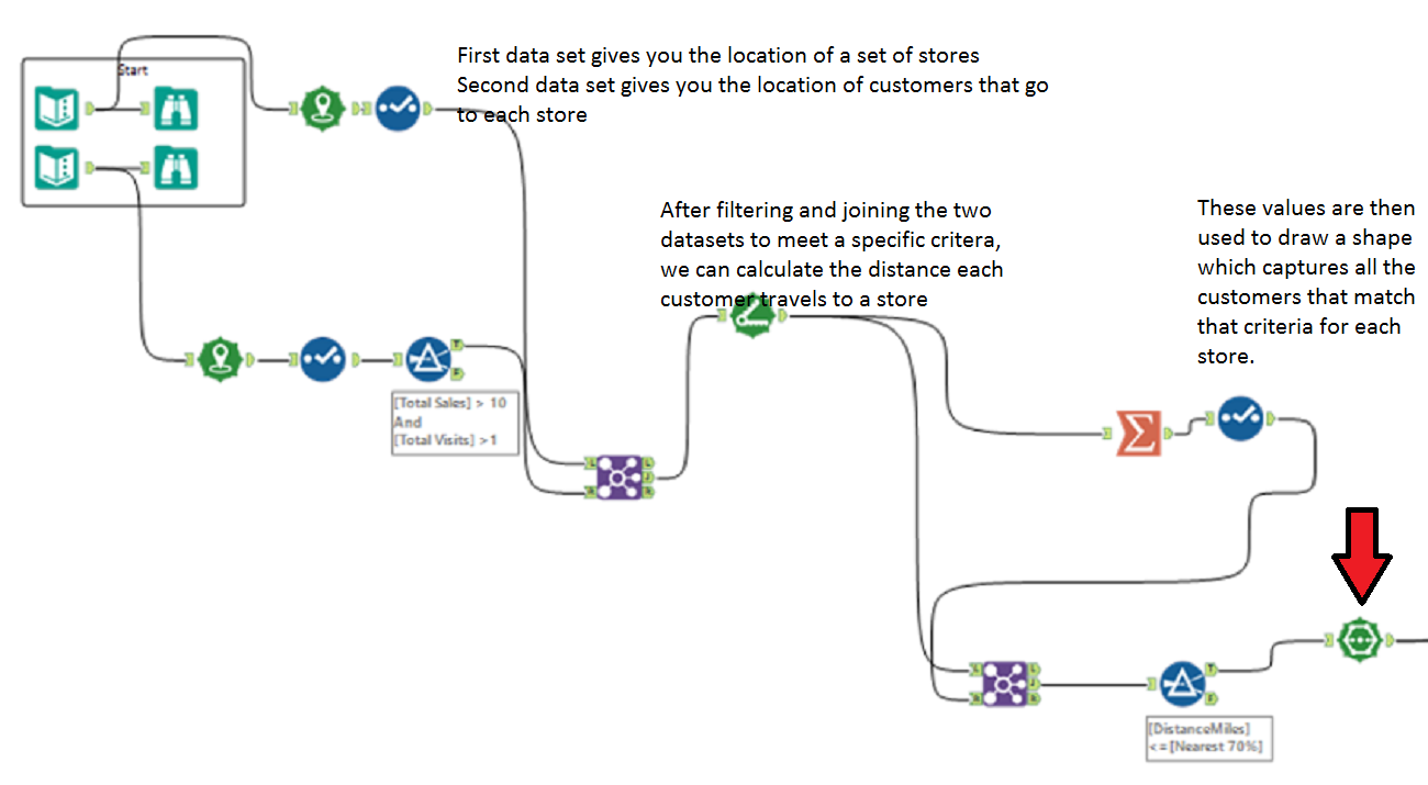
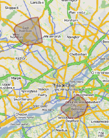
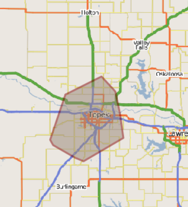
As we have 3 stores we have 3 different shapes. At the centre of each shape is the store and the customers at the top end of the 70% are making up the points that from the shapes outline.
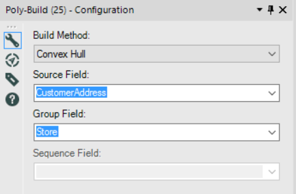
This is what your data needs to look like for this to work. The StoreAddress and the CustomerAddress are the fields that are being used to create the shapes on the map.
And here’s the configuration. The Source Field is what is creating your shape and the Group field is what those points are going to be grouped around.