Last time we looked at Postcode Geography. It is important to understand that Postcode Geography is independent to all the other geographies that we will look at in the next series of posts.
So, Census Geography, this is used by ONS to carve the country up into bitesize pieces to make data analysis easier. Why is this important? It is important because if you every download data from ONS it is likely to be broken up into one or more of these bitesize pieces.
There are loads of different Census Geographies, such as Built Up Areas, Enumeration Districts, Travel to Work Areas etc… but the most common that you will come across are Super Output Areas.
Middle Layer Super Output Areas (MSOA) – These are the largest of the 2 output areas. There 7,201 of these in England and Wales. They have a minimum population of 5,000 and a maximum population of 15,000
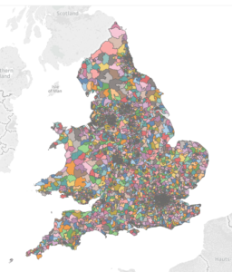
The shapefiles are available here: MSOA Boundaries
Lower Layer Super Output Areas (LSOA) – These are the smallest of the 2 output areas. There are 34,743 of these in England and Wales. They have a minimum population of 1,000 and a maximum population of 3,000
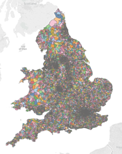
The shapefiles are available here: LSOA Boundaries
If you want to use these shapefiles in Tableau, I would advise you to use the Generalised or Super Generalised dataset to keep the load times to a minimum.
The interesting thing about Output Areas is the link to Local Authority (which is part of the Administrative Geography) each output area sits within a specific Local Authority, which means that you can technically combine the two! But more on that tomorrow.