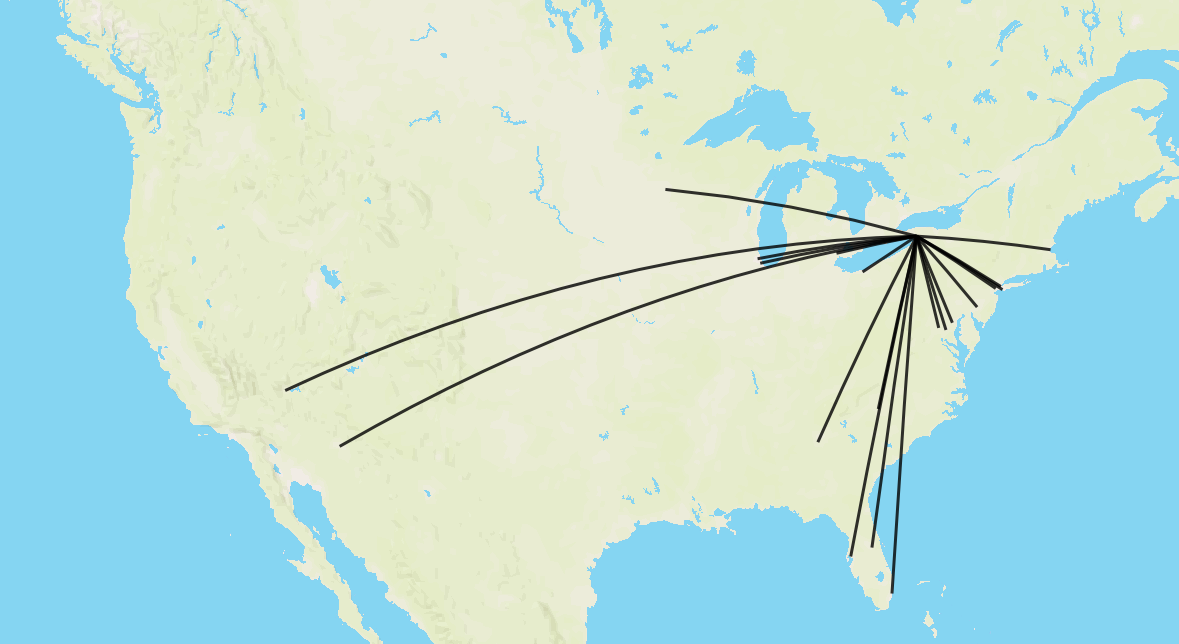
The Tableau help page defines the LENGTH() function as returning "the geodetic path length of the line string or strings". This simply refers to the fact that, as a sphere, the shortest route between two points will not usually appear as a straight line in a map. Geodetic lines are the shortest lines along the Earth's surface, and this is how Tableau creates spatial objects, as shown in the image below. This is comparable to flight route maps, as aeroplanes will (for the most part) take the geodetic line between two points.
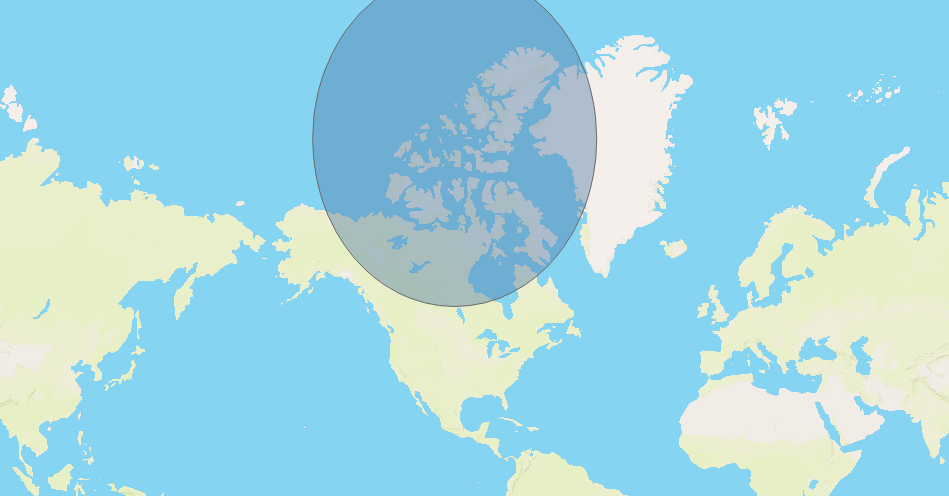
The geodetic nature of Tableau spatial objects can also be seen in buffers (circular polygons), which appear to warp and become non-circular when close to the poles, as in the example below.